
- 85
- 4 692 275
The Map Reading Company
United Kingdom
Приєднався 11 гру 2019
Map reading, Land Nav & Compass use are what we specialise in. FULLY qualified instructors offer everything from entry level advice up to advanced techniques on as many topics as we have time to create the videos for.
As you can probably tell from our videos we’re a small company which runs training courses in map reading, compass work and navigation, in every corner of England.
It would be great if you’d like to subscribe to the channel so that you’ll be informed when we publish new videos.
Click the link to subscribe:
www.youtube.com/@TheMapReadingCompany?sub_confirmation=1
Or, it would be even better if you would kindly join the channel as a member.
Click the link to see the benefits of joining the channel.
www.youtube.com/@TheMapReadingCompany/join
If you have any comments on our videos please post them as we read all them all, even if we can’t respond to each viewer individually.
How to follow a contour line
To stay at the same elevation, an altimeter can be extremely useful. An altimeter measures altitude, allowing you to know precisely when you are gaining or losing height.
However, if you don't have access to an altimeter, you can still navigate effectively using a map. Begin by identifying your current position on the map and finding a feature or landmark on the same contour line. It could be a rock, a tree, a path, or any distinguishable point that lies at the same elevation.
Once you have identified a point on the same contour line, walk towards it. It is important to note that the path you take does not have to be perfectly level. You might go up or down slightly along the way due to the natural undulations of the terrain. The key is to ensure that when you arrive at the intermediate point, you are at the same height as when you started. By repeating this process-identifying a point on the same contour line and walking towards it-you can maintain your elevation until you reach your final destination. This method, though simple, requires careful observation and map-reading skills, making it an invaluable technique for anyone traversing hilly or mountainous regions.
Переглядів: 2 120
Відео


Use an altimeter to help you navigate
Переглядів 3,7 тис.4 години тому
An altimeter is not strictly necessary when trekking or hill walking, but it can significantly enhance your experience and safety by simplifying and accelerating several aspects of navigation. Benefits of Using an Altimeter Enhanced Location Awareness: Identifying Position: Knowing your altitude can be invaluable when traversing a long slope with minimal distinguishing features. By comparing yo...

Sept 2024 Navigation Courses
Переглядів 1,1 тис.7 годин тому
All intermediate courses this year were fully booked, so I have added another weekend course. It will be will be in the Shropshire Hills (Church Stretton area) over the weekend of 21st Sept. 2024. There are just two spaces remain on the Novice course in The Chilterns (just north of London). Bookings can be made via our website and if you have any questions please contact me via the website. www...

Naismiths Rule explained
Переглядів 29 тис.Місяць тому
Naismith’s Rule is used to give a rough guide for how long it will take to walk somewhere in the hills. The basics are that if you know how far you have to walk and the speed you’ll travel at, then you can work out how long it will take. Naismith’s also adds in the time it will take to walk up what are described as Easy Slopes. If you add these two times together, the distance and height gain, ...

WHY do compasses point north
Переглядів 3,2 тис.Місяць тому
We all know that compasses point north but have you ever wondered why. In this short video I’ll try and explain just a little of the physics behind this. We’ll also look at why some materials can be magnetic and other can’t and, along the way, we’ll look at the very strange snacking habits of some people in New Zealand whilst they are out trekking in the hills and mountains.

How to rotate a compass bezel
Переглядів 3,9 тис.Місяць тому
The most common question I’m asked on novice and intermediate courses is "how to hold a compass whilst it's being rotated. Your compasses bezel needs to be rotated to take a bearing from a map. But how do you do that, how do you hold the compass so it stays still on the map. This video shows how I do it. But, as we’re all different it may not work for you. Give it a try and see.
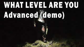
Navigation demo - Advanced Level
Переглядів 6 тис.Місяць тому
Walking safely in complex and possibly dangerous terrain involves using some advanced navigation skills. In this video I’ll follow a typical day’s walk in the hills to demonstrate some of the techniques which many advanced navigators use. 00:46 Difference between intermediate and advance navigation 01:35 Practice and experience 02:15 Precision 02:50 Contouring 03:30 Timing 04:12 Feature recogni...
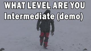
Navigation demo - Intermediate Level
Переглядів 9 тис.2 місяці тому
Using a typical, intermediate level, day’s walk in the hills to demonstrate some of the techniques which most competent navigators have. Route calculations 00:47 Route planning 01:28 Escape routes 02:03 Collecting features 02:52 Pacing 03:14 10m grid references 03:34 Grid bearings 03:50 Aiming off 04:30 Terrain type 04:50 The 10% rule 05:35 Timing errors 05:50 Multiple bearings 06:48 Contour in...

Navigation demo - Novice Level
Переглядів 9 тис.2 місяці тому
In this video we’ll discuss Novice Level Navigation. Don’t let the word Novice put you off as this where the vast majority of people are at, which is perfect for the type of outdoor walking they do. They may follow tracks or handrails (these are things like walls, streams, the edge of a wood, etc.) basically anything you can walk on or along. Using a map can also let you know how far away somet...
How well can you navigate ?
Переглядів 6 тис.2 місяці тому
This series of videos will help you understand the level of ability you’ll need to have to be able to call yourself a novice, intermediate or advanced navigator. Whichever type of walker you are from following well laid tracks or trekking over the hills or even walking in difficult terrain in poor visibility, the need to be able to navigate with a map and compass is a really important skill to ...
Windchill, how does it really work
Переглядів 7 тис.2 місяці тому
The original 1941 windchill index calculation, developed by Paul Siple and Charles Passel, was primarily intended to quantify the rate at which water would freeze under varying wind speeds and temperatures. This scientific tool aimed to provide insights into the freezing process and aid in understanding the impact of wind on environmental conditions. However, over time, misunderstandings have a...
Global Compass - how do they work
Переглядів 51 тис.2 місяці тому
While standard compasses may experience limitations such as needle dragging and erratic behaviour in regions with strong magnetic dips, global compasses have a separate magnet and north-seeking pointer to ensure consistent and reliable performance under various magnetic conditions. Standard Compass: • In a standard compass, the North Seeking Pointer is typically a magnetized strip or disk made ...
Micro Navigation - what is it and how to use it.
Переглядів 13 тис.3 місяці тому
Unlike conventional navigation, which tends to focus on broader routes or long-term orientation, micro navigation zooms in on the minutiae of movement, demanding a nuanced approach that encompasses a multitude of techniques and capabilities. Micro Navigation simply very accurate navigation over short distances. It isn’t a single technique; it is combination of many other navigation skills all a...
THIS is how to navigate using a map
Переглядів 17 тис.3 місяці тому
Watching videos or reading websites about land navigation you could be forgiven for thinking that Land Navigation is only about using a compass. Whilst being able to use a compass is very important in the real world most people will simply use a map to navigate and only use a compass if there is any doubt about their location of direction of travel. In this video I’ll try and show how the major...
Using cow poo as a compass?
Переглядів 6 тис.3 місяці тому
Is it really possible to use cow poo as a means of navigation. I was sent a message making this claim so I decided to go and see if it was true. The results weren’t convincing. I won’t say that it will never work but rather I couldn’t get it to work. I’ll leave you to decide for yourself.
Protractor Grid References - much simpler method
Переглядів 4 тис.4 місяці тому
Protractor Grid References - much simpler method
Compass bearing error calculation (advanced) P2
Переглядів 4,3 тис.4 місяці тому
Compass bearing error calculation (advanced) P2
Compass bearing error calculation (advanced) P1
Переглядів 3,3 тис.4 місяці тому
Compass bearing error calculation (advanced) P1
Which is better: GPS, Map and Compass or Phone App
Переглядів 9 тис.4 місяці тому
Which is better: GPS, Map and Compass or Phone App
How many lakes are there "really" in The Lake District - there's more than 1
Переглядів 2,9 тис.4 місяці тому
How many lakes are there "really" in The Lake District - there's more than 1
Magnetic Declination - a VERY simple explanation
Переглядів 7 тис.5 місяців тому
Magnetic Declination - a VERY simple explanation
Dead Reckoning for Land Navigation
Переглядів 14 тис.5 місяців тому
Dead Reckoning for Land Navigation
Do not orient a map - when using with a compass
Переглядів 168 тис.5 місяців тому
Do not orient a map - when using with a compass
Why does a tritium compass glow - The physics behind it
Переглядів 4,3 тис.5 місяців тому
Why does a tritium compass glow - The physics behind it
THIS is how to navigate in a forest - Forest Navigation done correctly
Переглядів 293 тис.6 місяців тому
THIS is how to navigate in a forest - Forest Navigation done correctly
you must write a book so us old guys dont forget😊.
I love your content! Outstanding stuff... and presented in an accessible way. Just an offering to the algorithm gods... like, comment, subscribe and hit the all notifications bell, y'all!!! When I first saw your chart onscreen I was "that's some interesting terrain to have a 390/490 contour line!" and then I learned it was an error and you reported it to the Ordnance Survey.... BZ! Anyway... keep them coming.... sending out positive vibes from Canada.
The best orienteering channel on the internet. Period.
I’ve been following your channel for some time, I must say, I enjoy when you add history in your tutorials!! It an awesome journey, on what happened in the UK. Thank you so much for sharing your tutorials, your an awesome instructor and inspiring, it helps me stay in the woods with confidence!!👍🏽👍🏽👍🏽🇺🇸🇺🇸🇺🇸👊🏿 from Washington state.
Continual assessment is a key component to apply.
Hello! Congratulations on this content. Your channel is amazing! Could you please make a video recommending books on land navigation? It would also be interesting to see your opinion on these books. Even making a division between books for basic, intermediate and advanced levels.
Oldest point I've been to been set in Mason Neck Wildlife Refuge....
👍
For goodness sake don't walk up Icknield Street (Roman) instead of along Icknield Way (Pre-Roman)... you'll end up in Yorkshire !
The latest video I posted was filmed on Mastiles Lane - another Roman Road. ua-cam.com/video/DxnnDmnzsT8/v-deo.html
When you set your compasses on the ground the needle stabilizes rapidly. Mine swings back and forth almost 160 degrees for over 10 seconds. Are there a lot of magnetic rocks in my area?
It sounds like you have an un-dampened compass or there is something wrong with the pivot. I'd get a new one - either suunto, silva, brunton, or some other well known brand (I never advise people on what to buy, sorry) Mind you, I had a guy on a course a few weeks ago who’s compass was going wrong. I lent him one of mind and the same thing happened. Turns out he was wearing a metal emergency wrist band.
Great video! Next I’ll watch Time Team go into badger mode and dig holes in the wall😊
I have played out a scenario in my mind. It being, I have hiked 3 miles into the wilderness from my car/trailhead and camped overnight. Next day I have to go home but it's snowing and it's a whiteout. I know the general direction I need to go. I notice on the map a contour line takes me very close to my destination. Could one follow that line to get back to the trailhead using the altimeter? ( This is hypothetical; I have a GPS with SOS and map and compass and altimeter of course in reality, but I can't see more than a foot in front of me). What would you do in severe fog (we call it tule fog on the West Coast of the USA)
If you have an altimeter then yes following the contour back to your car would seem a good option. Mind you (just in case) if your car is on a road I would tend to Aim Off slightly to make it certain that you'll get to where you want.
@@TheMapReadingCompany Actually, if you'll humor me, what could a person do if they were in a white out and they didn't know where they were. And said person had trekked around for awhile trying to find the trail or such. Obviously sit tight is the logical answer, but suppose you had to head somewhere. And your GPS-SOS died, but your cell phone is getting an altimeter setting, but that's all. Your map software died for some reason, but you have a paper map and a compass. Are there any possibilities in that situation?
I’m famous 😮 Thank you for answering my question. 👍
Maybe one needs to use a toothpick as one does testing the doneness of a cake.😂 At any rate, I think you'd have to turn the cowpie over, carefully, preserving direction and see if one side is more dry.
Just curious, but I have Topo Maps with the declination diagram stating that the declination Increases Annually 3.3 degrees. The current declination is 10.3 degrees west. Does INCREASING mean it gets further west each year or moves closer to the true north alignment. Some maps also refer to a decreasing declination rather than simply stating a west direction or east direction. Thanks for any clarification of the above. Cheers!
Decreasing is normally used to say the declination is moving towards True North, increasing means it's moving away - basically the declination is getting bigger or smaller. So 10.3 west or east + 3.3 increase = 13.6 10.3 west or east - 3.3 decrease = 7
@@TheMapReadingCompany Thanks for the quick response, they are older topo maps so after figuring the years and changes to declination wanted to ensure I was headed in the correct direction. Cheers!
great video Thanks , sometimes there are two line on bezel (one with magnifying lens). which one should be used ?
I have just filmed a video answering this exact question about the two lines on the glass. It will take me a while to edit it but as soon as I have I'll post it. These types of compass are NOT used in the same way as a cammenga - - - - and yes I've seen the videos where he says it is ??
@@TheMapReadingCompany looking forward to watch your new video. Regards
👍👍
Interesting tip i never remarked it but nice to now. The fix Magn. Decl. scale on the North side of the compass, the adjustable scale a-on the South side. Maybe i have never remarked or seen this because al my compasses always had a adjustable scale.
Interesting. I've found that a barometric altimeter is only reliable if the weather is settled. If a low pressure system is close by then the pressure will fall or rise significantly over a few hours. I've had my Suunto Core watch read 30m different at the end of of a run / walk than it did at the start, despite me being back at the same place! Yes you can recalibrate it at known heights during your walk but it's a bit of a faff. A good experiment is to set it for the known elevation of your home and leave it in situ on your desk etc for several hours and see if it thinks you have gone up or down in elevation. Also some GPS watches are more accurate than others. My Coros Apex Pro watch seems to be more reliable than my Garmin Fenix.
Thank you for the explanation.
arrhhhh, now i understand you, it was just semantics from my part. I always oriented my map back in the day when I knew how to use it properly, having a map not oriented just didn't make sense to me.
so a prismatic is better in my opinion
Your waffling adds a lot of "character" to your videos. I love it.
"Goodness is that the time?" "No, it's a barometer." "In that case it's high pressure I was off" Two Ronnies c1970's
If using the OS Locate app (and potentially others) on your mobile phone, be aware that the GPS reference ellipsoid zero height does not match the UK sea level at Newlyn with a height difference of 55m, so somewhere in the processing that 55m GPS to sea level difference has to be compensated for. Certainly on my mobile phone it's either done twice, or never, and when I look at the GPS indicated heights they are 55m 'wrong'. Different systems make different 'mistakes'. Always check your own readings.
I’m lucky to have both these watches and love both of them! I’ve had my Suunto Core for 14 years and never get tired of looking at its face. I’ve only had my Fenix 7X for a month but it’s incredible. I’m only just learning how to use it but so far its capabilities blow my mind. Thanks for all the effort you put into your videos. I’m ex infantry and precise map reading is a necessity in all conditions and you’re a great instructor. I also paraglide and use a dedicated leg strapped altimeter/vario (Flymaster) which is much faster/responsive at reading and displaying height changes.
Saluti dall'Italia, e grazie mille per tutti questi video magnifici!!!!
Welcome back buddy, I missed your company. 2 very important questions: 1: what kind of tea are you drinking? 2: do you brew the tea first and then put it in the thermos or (3) just put hot water in the thermos? Waffling on here with another, do you have a brown Betty? I just picked one up here in the PNW at a thrift shop for $12. I'm really getting into this tea thing as a former espresso guy. I'm drinking PG Tips and just recently got turned onto a Chinese black tea. Gimme a PO box or something and I'll send you some to try in return for all of the education you,ve contributed to my existence! Later, dude. Okay then, one more... Milk? Sugar?
PG Tips ???? Not sure many people (other than tourists) drink that anymore. Yorkshire Tea bags are the way forward. If you get the ones with the string you can make tea in the flask, which keeps it hotter, longer. Oh and I know folk used to put the milk in first - so the boiling water didn't crack the thin porcelain cups, but cups (and flasks) are more rugged now - I put the milk in after.
Hi, love your videos. Can I just correct a small mistake? At 4.30 you make the very common mistake of saying satellite navigation can triangulate your position. In fact it's known as trilateration as positioning is done by the difference in time of the arrival of the different satellite signals. As you will know triangulation is the fixing of your position by taking angles. Even a major satnav (GPS) manufacturer once printed this mistake in their brochures so you're not alone. Two satellites give a position, three will give altitude as well.
It's great for the Scottish Munros when the chance of a cloud free summit is low, it's a long ridge with lots of false tops, and the kids (and other 'followers') keep asking "Are we nearly there yet" after each and every steep rise! Also great for knowing when to expect to reach cols, or traverse past problem terrain.
Can you make a video on strategies for Micro navigation in bad weather when there are very few collecting/catching features, handrails, visible references
Many weather apps will give you the current barometric pressure for an area. So, you can enter that into your barometric altimeter before you start your walk. Also, you don't need to spend £££ on a dedicated altimeter as there are many phone apps that will give your GPS altitude and many smart phones can measure barometric pressure.
Id never even thought about using my watch that way, I guess I rely on other forms of measure and havent kept up with the times. Its another useful tool for my toolkit, thanks for making this video and sharing your always impressive knowledge!
To say it’s expensive is an understatement. $134 currently!
I like that the barometric altimeter does not depend on GPS. Reception has become spotty in some parts of the world, suffice it to say. GPS won't always be there but air pressure will.
I usually do not walk across country, but sometimes for me, an altimeter is very useful. I use a 12 year old casio Protrek wristwatch. One of its features is a barometric sensor and a display either in hPa or height, which eventually calculates from the air pressure, as all barometric altimeters do. At sea level, this air pressure decreases at about 1 hPa per 8 m height gain. But there is a circadian rhythm, which today changed within 16 hPa (sic!). And there is variable moisture in the air, which makes it - and thus the pressure - lighter, Hence, barometric altitudes are random numbers, if one does not have reference points again and again, especially if the walk extends over hours. I find it tedious to always recalibrate my altimeter. I just memorize, how much I am wrong at a known point, and subtract or add the difference.
Hello, I have been watching many of your videos lately and as I enjoy the skill of navigation, I have been eager to watch the next video. I also have been enjoying your Waffle into history or other tangents of topics. Cheers!
2:10 Altimeter, not GPS ;-)
Oh - I didn't notice that, well spotted.
@@TheMapReadingCompany no problem. Very good content btw, always something new to learn 👍
Sounds like I hav to tell my altimeter my altitude more than I need it to tell me.
Barometric Altimeters are also handy for weather changes approaching, set to 0 and in the morning see if it went above or below the 0 mark. Below is an indicator of low pressure and possibly RAIN. Conversely above represents a high pressure system and plenty of clear skies. Interesting tools indeed ! Cheers!
Got an ABC watch and I should use these features more offen, GPS has made me very lazy. Thanks for sharing your knowledge ❤.
Thx a lot Sir, I learned something new today....as I usually do when I watch your videos :) Wish I could join your nav courses. Greetings from Copenhagen.
Interesting and more uncommon topic. Thank you for makng this video I 'look after' a handful of OS benchmarks in my home area. A neat infill of yellow paint keeps them visible and hopefully less likely to get interfered with. There is some nostalgia in my motivation but mainly they are to provide a handy local reference for calibrating portable barometers /(altimeter) to QNH. The paint makes a difference , our yellow crowsfeet have apparently featured on a local interest Facebook site. (An Irish boatman).
Enjoyed the video very much. One way I've used altimeters is to follow a contour line, say, 530 meters until I achieve a specific compass heading then use that as an attack point. Again, great video and instruction! Cheers
Would being under a fleece sleeve or waterproof coat affect the accuracy of the barometric altimeter - ?
That's a good point - I don't know the answer, but maybe body heat would increase the air pressure.
@@TheMapReadingCompany As long as the Altimeter is not in a completely airtight enclosure, I find it hard to believe that it affects much. Especially not when the smallest unit of measurement is a meter.
If I ever get over to Great Britain, I’ll be sure to drop in.
Oregon to UK - it's not that far 😊
What do you think of the thommmen altimeter bit old school i know but not reliant on batteries.
I saw someone using one a few years ago but I've never had one so I can't offer any comment. But they do look fun.
In mountaineering we use them quite a lot, for example when navigating a cliff face we use them to find the start point of the climb/route, where bivi spots are etc, also for checking you are at the correct summit point when at the summit (when there’s no trig point) the gps ones are way better for accuracy when using them for mountaineering as the whole air pressure thing becomes a lot more noticeable when your hanging around and not moving at belays.
I’ve been following your channel for a while, I really enjoy your channel and content, love seeing the country side across the pond, looks awesome, also, I have learned so much with your tutorials, I’ve applied the knowledge, it’s an awesome feeling knowing that I haven’t got lost, yet! 🤣. Thank you so much for sharing your knowledge. From Washington state, USA. 👍🏽👍🏽👍🏽🇺🇸🇺🇸🇺🇸❤️👊🏿
Thanks for your kind words.
50 years ago my survey boss had a barometer/altimeter in a big wooden box that we’d calibrate at post office elevation markers. I think it read to ten feet increments and it worked great for figuring out where you were in the mountains if you had a good topo map.